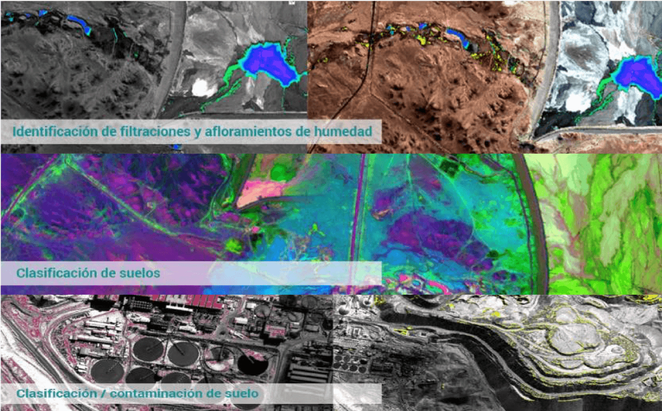
We know that soil pollution causes a chain reaction. It alters soil biodiversity, reducing its organic matter content and its capacity to act as a filter and water stored in the soil and groundwater also becomes contaminated, causing an imbalance in their nutrients.
Through satellite imagery, laboratory tests, and fieldwork, we can contribute to diagnosing the affected areas to develop management plans that allow for the recovery of the affected coverage.
Environmental impacts
Satellite studies
Particulate matter
Environmental audits
Carbon footprint
Soil organic carbon
Carbon credits
Environmental impacts
Satellite studies
Particulate matter
Environmental audits
Carbon footprint
Soil organic carbon
Carbon credits
Environmental impacts
Satellite studies
Particulate matter
Environmental audits
Carbon footprint
Soil organic carbon
Carbon credits
Through remote sensing and image processing techniques, we can collect and analyze natural or anthropogenic events for better resource management.
Support is provided through monitoring environmental variables via parameter mappings: soil, vegetation, and particle dispersion in the air.
By using environmentally friendly technologies with a preventive focus, monitoring and tracking of events are carried out to reduce risks of environmental vulnerability.
Through remote sensing and image processing techniques, we can collect and analyze natural or anthropogenic events for better resource management.
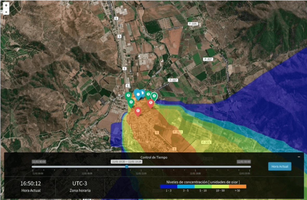
Through image processing, we can model the dispersion of particles from their origin and how they behave under certain atmospheric conditions, allowing for the preventive development of environmental management plans.
Through diagnosis processes and verification of compliance with environmental obligations, we can identify possible non-compliant environmental instruments.
Implementation of procedures and capacity-building techniques for the development of internal environmental audits.
Measuring, managing, and reducing the carbon footprint to reduce the negative impact of companies' activities is key to improving relations with stakeholders and complying with regulatory norms.
Measurement of organic carbon in soils through a method that combines soil organic carbon (SOC) models with remote sensing, allowing for the measurement, reporting, and verification of organic carbon for carbon projects and carbon credits.
In recent decades, carbon credits have emerged as a powerful financial incentive for companies, NGOs, and governments seeking to reduce their climate footprint.
These initiatives are based on the Kyoto Protocol or the Glasgow Climate Pact.
There are validation and verification procedures to generate carbon footprint credits.
We are in the early stages of developing our first projects. We hope to deliver progress soon.