

Asset integrity

Moisture leak detection

Acid irrigation control on leach piles

Moisture monitoring and tailings deposition

High-range cameras
Asset integrity
Moisture leak detection
Acid irrigation control on leach piles
Moisture monitoring and tailings deposition
High-range cameras
SAR interferometry satellite service, which allows for the identification of settlements or displacements with millimetric precision.
This technology enables the evaluation of concentrator plants, cathode plants, thickeners, pumping stations, transfer stations, and surface ducts, as well as the monitoring and control of roads, high-tension lines, railways, among other assets (critical infrastructure not operated by the site).
In addition to evaluating earth displacement due to extreme weather and/or earthquakes


Our technology specializes in detecting leaks in mineral and water transport pipelines.
Satellite imaging technology applied for subsurface analysis with a spatial resolution of -3 meters locates and identifies moisture caused by leaks from underground pipes, allowing for planning and expediting their repairs.
Complete water systems can be monitored and analyzed. Even leaks that are not on the surface or have not left evidence can be detected.
Maintenance personnel can then be utilized with maximum efficiency.
No on-site personnel are required for the development of this service.
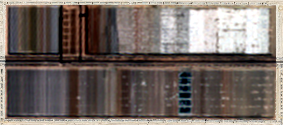
At BM, we have satellite images generated every 3 to 5 days, with a resolution of 1.5 meters, which allows for the analysis of leach pile irrigation and even determining areas with excess moisture that jeopardize pile stability and irrigation process failure.
This technology avoids the installation of in-situ monitoring equipment such as thermographic cameras installed on monitoring towers, which have associated risks such as falling objects and falling personnel from height due to camera maintenance, in addition to the costs they entail.
This service does not require on-site personnel.
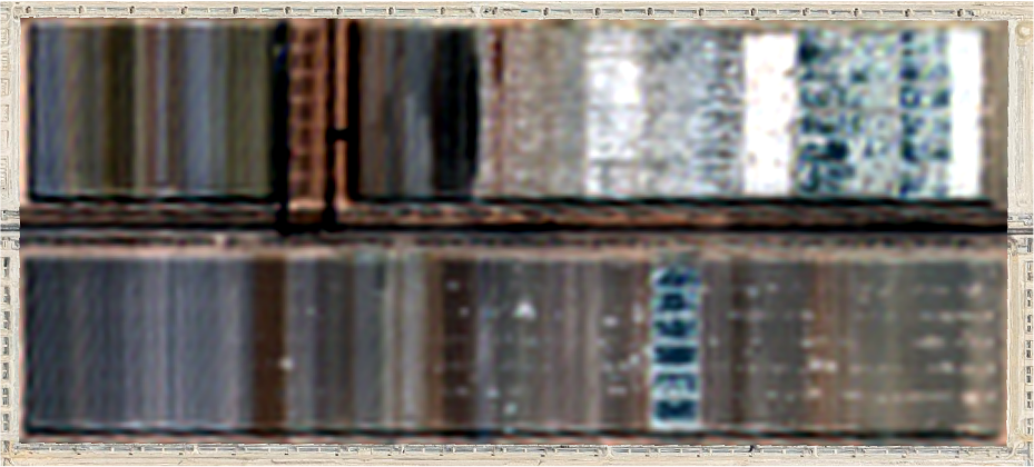
* Each quadrant is georeferenced.
Natural Color - 1m Resolution. July 16, 2024.
Natural Color - 1m Resolution. July 21, 2024.
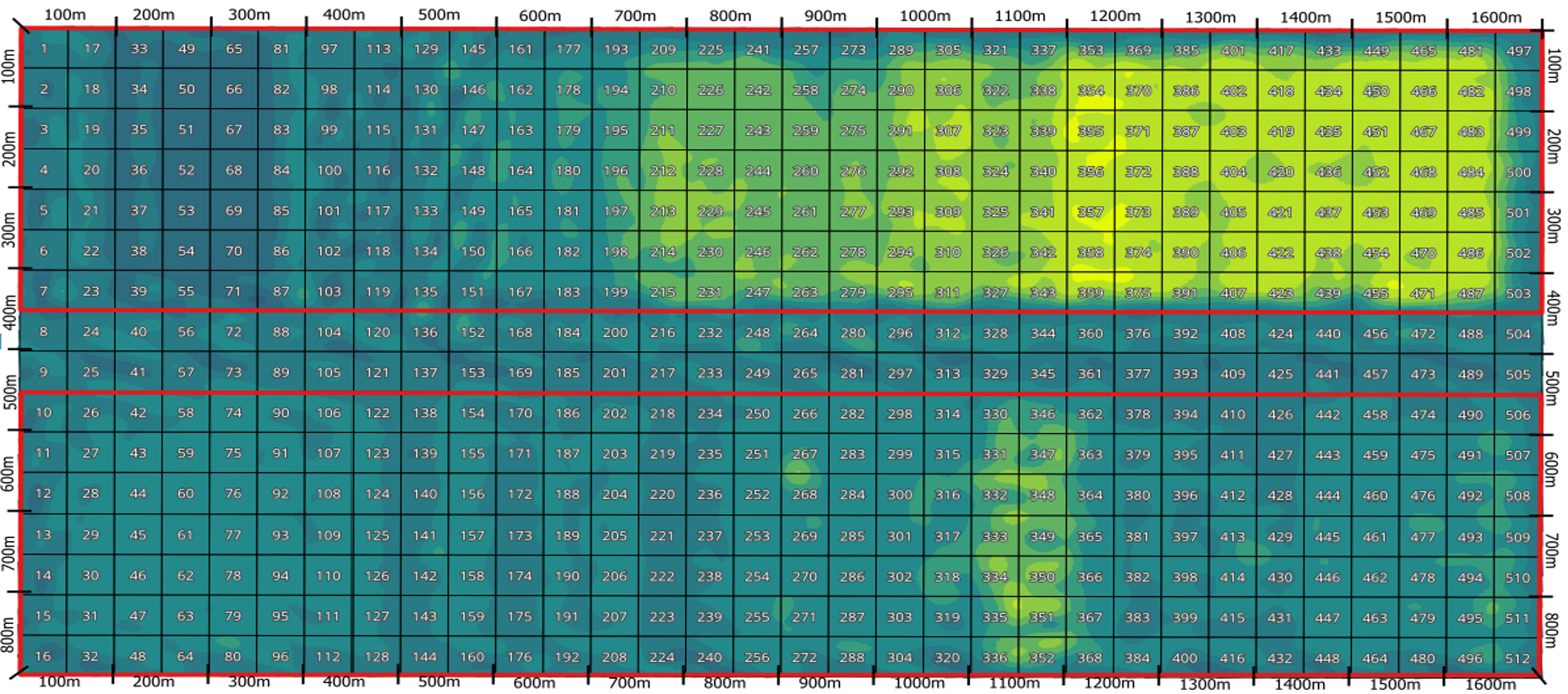
Detailed humidity with zoning and 50-meter grid.
Resolution of 1 m. July 16, 2024.
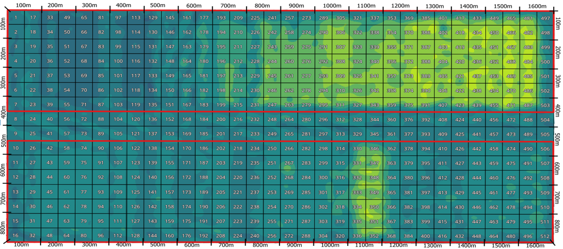
Detailed humidity with zoning and 50-meter grid.
Resolution of 1 m. July 21, 2024.

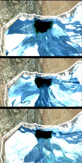
We offer a satellite constellation with daily revisits in natural color and NDMI (Normalized Difference Moisture Index) for moisture analysis anywhere in the world, with a spatial resolution of 3 meters, capturing images in four multispectral bands within the RGB and NIR ranges.
This allows for monitoring and control of tailings discharges.
As an example, the attached images are a sample of a natural color image at 3 meters resolution and one with NDMI moisture index.
It is possible to observe the discharges in tailings, where it is possible to observe, for example, how they affect the lagoon.
This information, in the hands of experts in the field, can contribute to the management of mining tailings.
With satellites returning daily or every 3 to 5 days, with a spatial resolution of 3 meters, taking images in four multispectral bands within the RGB and NIR ranges, which allows for natural color delivery, it is sufficient for expert decision-making.
Cameras with ranges of up to 20 kilometers. Automatic identification of targets with AI.
Furthermore, these cameras feature hot spot detection through dual sensors, developed based on the latest generation of technology. An embedded AI module, a hot spot detection algorithm, allows for the automatic detection of fires, vehicles, people, and other heat sources.
This service includes surveillance software as well as fire detection.
Equipment maintenance service.
